


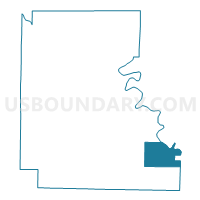
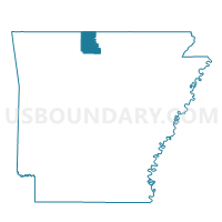
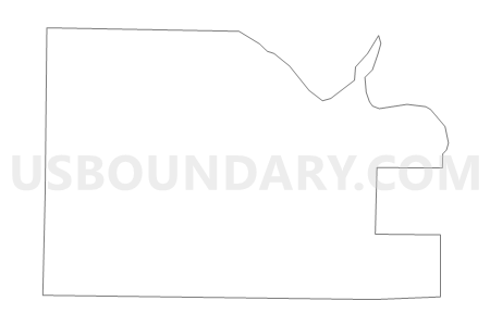
BUFFALO Voting District, Marion County, Arkansas
About
Outline

Summary
| Unique Area Identifier | 527281 |
| Name | BUFFALO Voting District |
| County | Marion County |
| State | Arkansas |
| Area (square miles) | 20.85 |
| Land Area (square miles) | 20.52 |
| Water Area (square miles) | 0.32 |
| % of Land Area | 98.46 |
| % of Water Area | 1.54 |
| Latitude of the Internal Point | 36.14833630 |
| Longtitude of the Internal Point | -92.44511880 |
Maps

Graphs
Select a template below for downloading or customizing gragh for BUFFALO Voting District, Marion County, Arkansas


Neighbors
Neighoring Voting District (by Name) Neighboring Voting District on the Map
- Voting District 11-2, Baxter County, AR
- Voting District 11-4, Baxter County, AR
- BEARDEN Voting District, Marion County, AR
- BIG CREEK Voting District, Marion County, AR
- CROOKED CREEK Voting District, Marion County, AR
- JEFFERSON Voting District, Marion County, AR
Top 10 Neighboring County Subdivision (by Population) Neighboring County Subdivision on the Map
- Marion County township, Marion County, AR (16,653)
- Buford township, Baxter County, AR (1,295)
- Matney township, Baxter County, AR (107)
Top 10 Neighboring Unified School District (by Population) Neighboring Unified School District on the Map
- Mountain Home School District, AR (33,097)
- Flippin School District, AR (7,226)
- Searcy County School District, AR (6,747)
- Yellville-Summit School District, AR (6,259)
- Norfork Schools, AR (3,800)